A good majority of the area is still in a SLIGHT RISK for severe weather. (Latest Map below) The next updated SPC maps/discussion is scheduled by 4:00 PM-UTC time.

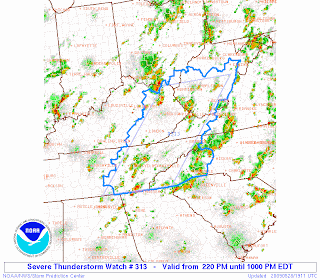
The more widespread severe weather will be confined to Eastern Tennessee, and Southern/Eastern Kentucky, and in fact that area is under a SEVERE THUNDERSTORM WATCH (as depicted below).

We still have potential to see some isolated severe weather. Severe storms that do develop will have the potential to produce severe hail up to at least quarters and damaging winds in excess of 60 MPH. I am NOT expecting a widespread severe weather event, but any storm that can get it's act together will have the potential to produce some damage.

.jpg)
No comments:
Post a Comment